
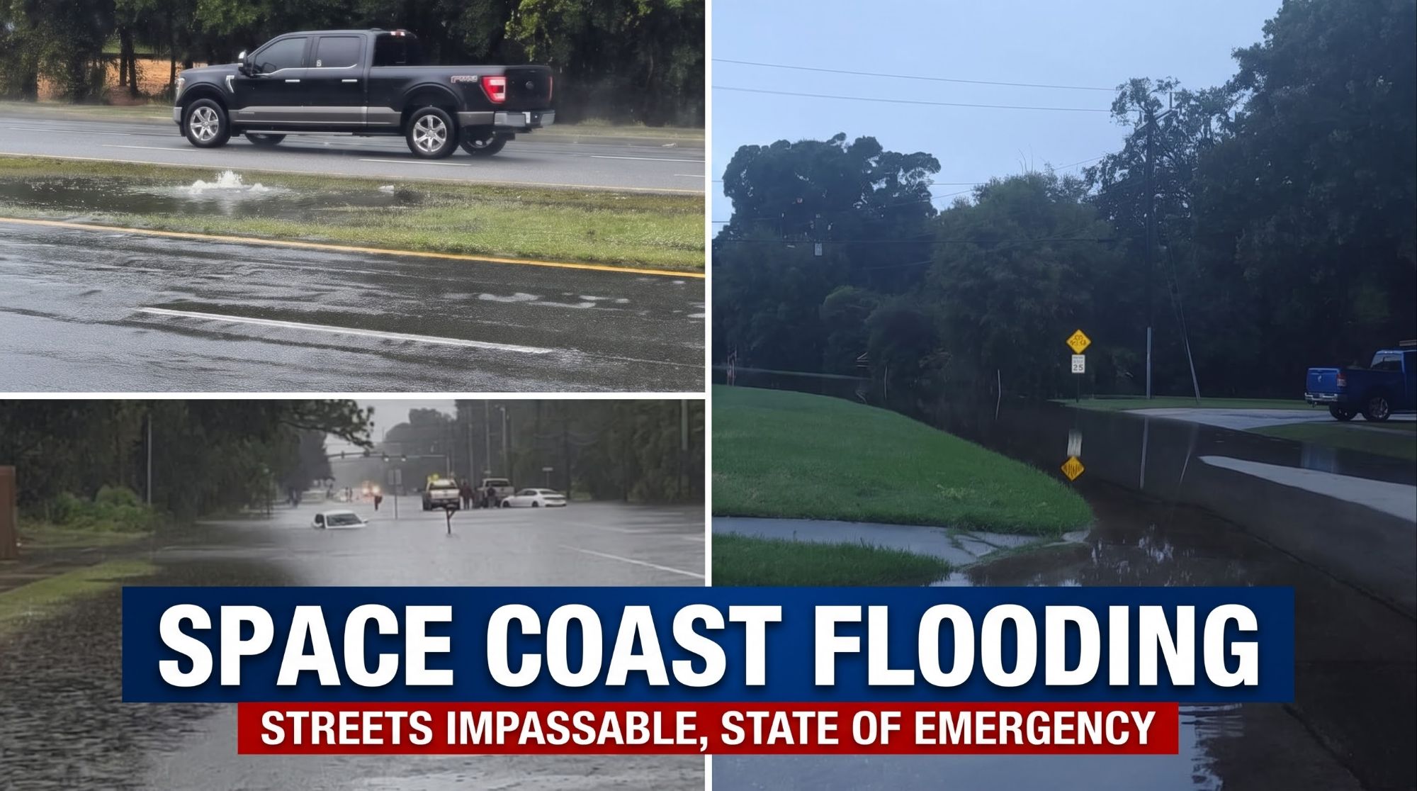
Relentless rainfall across the Space Coast has prompted widespread closures across North Brevard on Friday, November 20, shutting down Titusville City Hall, all Brevard Public Schools, major regional highways, and non-emergency healthcare clinics as crews battle severe street flooding.

The City of Titusville remains under a seven-day Local State of Emergency, with city officials warning that total event rainfall accumulations could reach up to 20 inches by the time the storm system tapers off late Friday into early Saturday.
The NWS Melbourne forecast calls for:
- Friday & Tonight: Ongoing showers and windy conditions throughout the day, transitioning to lingering showers and breezy winds tonight.
- Additional Rainfall: Forecasters project an additional 2 to 4 inches of rain across much of the region through Saturday, with localized totals of 4 to 6 inches possible along the Brevard and Volusia coasts.
- Coastal & River Hazards: A High Surf Advisory and Rip Current Statement remain active through Saturday evening, while River Flood Warnings are in effect along the St. Johns River—where water levels at Geneva have already reached major flood stage.
School, Municipal & Utility Updates
Brevard Public Schools: All campuses and district offices are closed Friday, Nov. 20. Because next week is Thanksgiving Break, students and staff will remain out all of next week and return on Monday, November 30. (Neighboring Volusia and Flagler school districts are also closed Friday.)
City of Titusville & Utilities: City Hall and all non-emergency municipal facilities remain closed Friday. Officials ask all residents to turn off their irrigation systems during this rain event. Additionally, solid waste collection is temporarily suspended until the county landfill resumes normal operations, and no additional sandbag deliveries are anticipated today. The city’s Disaster Assistance Program remains open.

NWS Melbourne Forecast: More Rain and Windy Conditions Tonight
According to the National Weather Service (NWS) in Melbourne, a Flood Watch remains in effect through 7:00 p.m. Friday evening for Brevard County.
Meteorologists report that heavy rain falling on already saturated ground will continue to aggravate flooding along the Brevard and Volusia coasts as a broad area of low pressure near southeastern Florida and the northwestern Bahamas moves northward.
Healthcare Operational Updates
Parrish Healthcare announced that while Parrish Medical Center (951 N. Washington Ave.) and its emergency department remain fully operational for emergency and inpatient care, all non-emergent outpatient services are closed through Sunday, November 22.
Closed Facilities: All Parrish Medical Group (PMG) outpatient clinics across Titusville and Port St. John, The Children’s Center (5650 S. Washington Ave.), and the Parrish Health & Fitness Center (2210 Cheney Hwy.) are closed through Sunday.
- Patient Appointments: Non-emergent procedures are canceled, and clinic staff are contacting patients directly to reschedule.
- (Note: Health First has also canceled elective procedures across its facilities for Friday due to travel hazards.)
Titusville & Regional Roadway Conditions
Officials are urging residents to stay off the roads unless absolutely necessary for safety. In addition to local street flooding, regional access is restricted by major highway closures—including State Road 46, which is closed in all lanes at the St. Johns River due to rising floodwaters, and State Road 520, which experienced full-lane closures due to flooding.
As of the City of Titusville’s 7:00 a.m. Friday update, local roadway conditions are as follows:
Impassable Roads:
- Cathedral Way / Crystal Ct.
- Harrison / Demaret (in front of Crescent Wood Assisted Living)
- Harrison / Royal Oak
- Raney (between Florencia and Willowgreen)
- Hemlock / Slashpine / Hickory Lake
- Barna / Country Club Dr.
- Merry Lane
- Deleon Avenue (Elizabeth / Cora area)
Nearly Impassable / Active Flooding Reported:
- Capron / Knox
- Crest / Overlook
- Barna / River Oaks
- Near 3860 Fox Lake (flooding beginning)
- Significant flooding in the rear southwest corner of 915 S. Park Avenue (Village at Valencia)
- Additional flooded intersections: Barna / Milton, Barna at Station 13, Tropic / Nidy, Day / Elizabeth, S. Deleon / W.C. Stafford, Knox / Hopkins to U.S. 1 eastbound, N. Dixie / Kel, Sedgwick / Kel, Knox McRae / Alpine, and near 4795 Key Largo West.
Passable with Caution / Areas Under Monitoring:
- 405 / Park: Barricade placed on road hazard.
- Singleton (between Tropic and 405): Passable with warning signage posted.
- S. Hopkins: Minor road damage; passable without closure.
- Oakhill and Country Club: Passable.
- High-Concern Monitoring Zones: Northbound U.S. 1 / Marina (at the base of the bridge) and Country Club Dr. / Oakhill / Raney.
Safety Reminder & Official Resources
Emergency officials remind motorists never to drive around barricades or attempt to cross flooded roadways, reiterating the warning: “Turn Around, Don’t Drown.”
Residents can monitor ongoing updates directly from the City of Titusville:
Current Rain Event – City Manager’s Update
Current Road Closures



Leave a Reply